The region of Siberia is among the best places for nature tourism, since the absence of a large population, we can find vast expanses of land in a virgin state, where we can immerse ourselves into nature and enjoy the surroundings.
We have made a compilation of the walking routes that you can enjoy departing from Puebla de Alcocer, including some in which you will need to take the car to start them, but due to their charm, we could not pass up the opportunity to show them to you.
We propose to combine sport, culture and environment, so you can enjoy unforgettable days in the vicinity of Puebla de Alcocer.
-
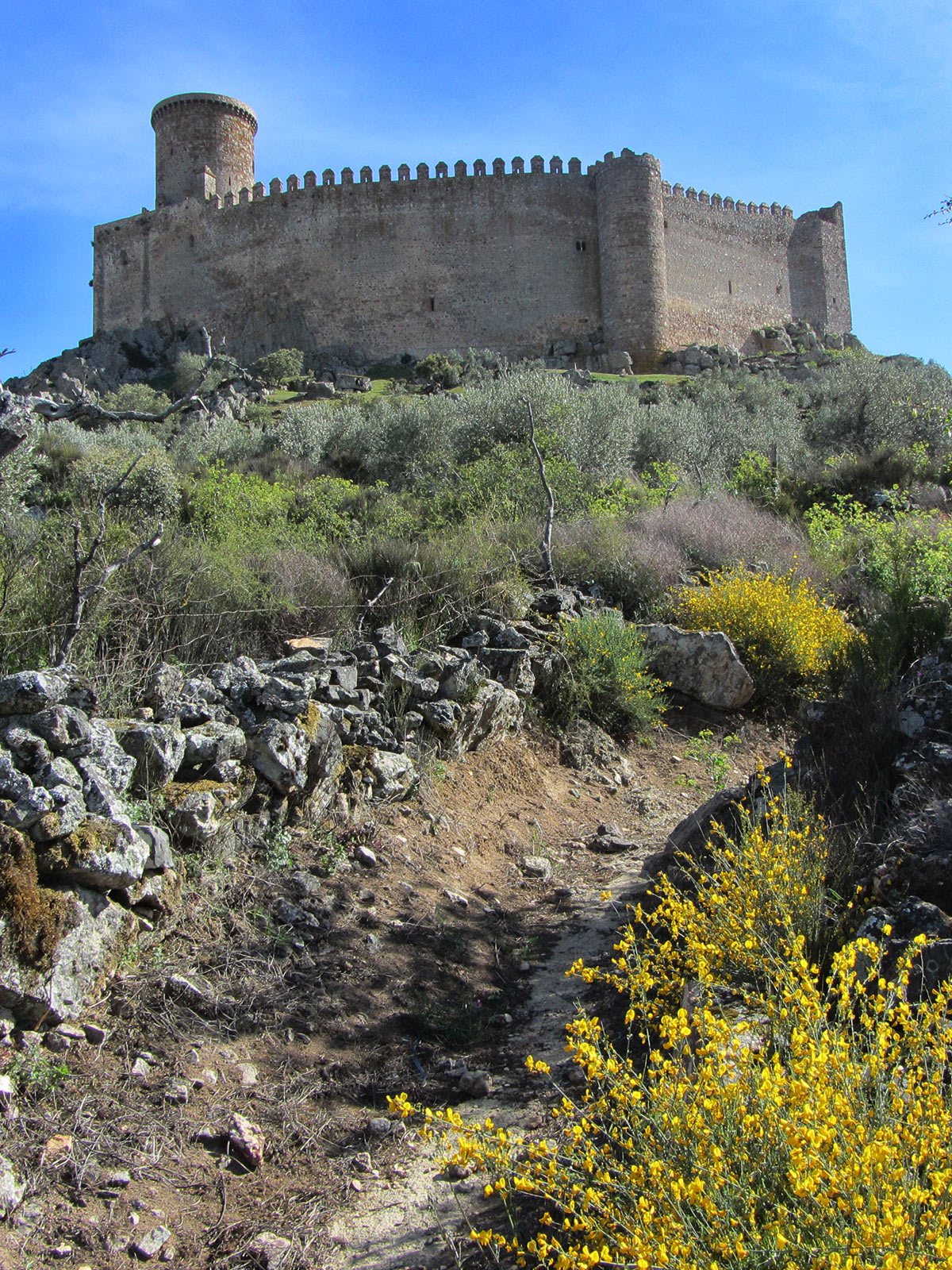
1. Castle Route Puebla de Alcocer
(693mts, Total length (return) 1.5 km approx.)It is the historic climb that leads to the castle from the village, you can do it from anywhere in the village, it goes through «the espeñas» and into a narrow street that ends at the foot of the castle. We finish this route making a visit to the Castle of Puebla de Alcocer.
-
-
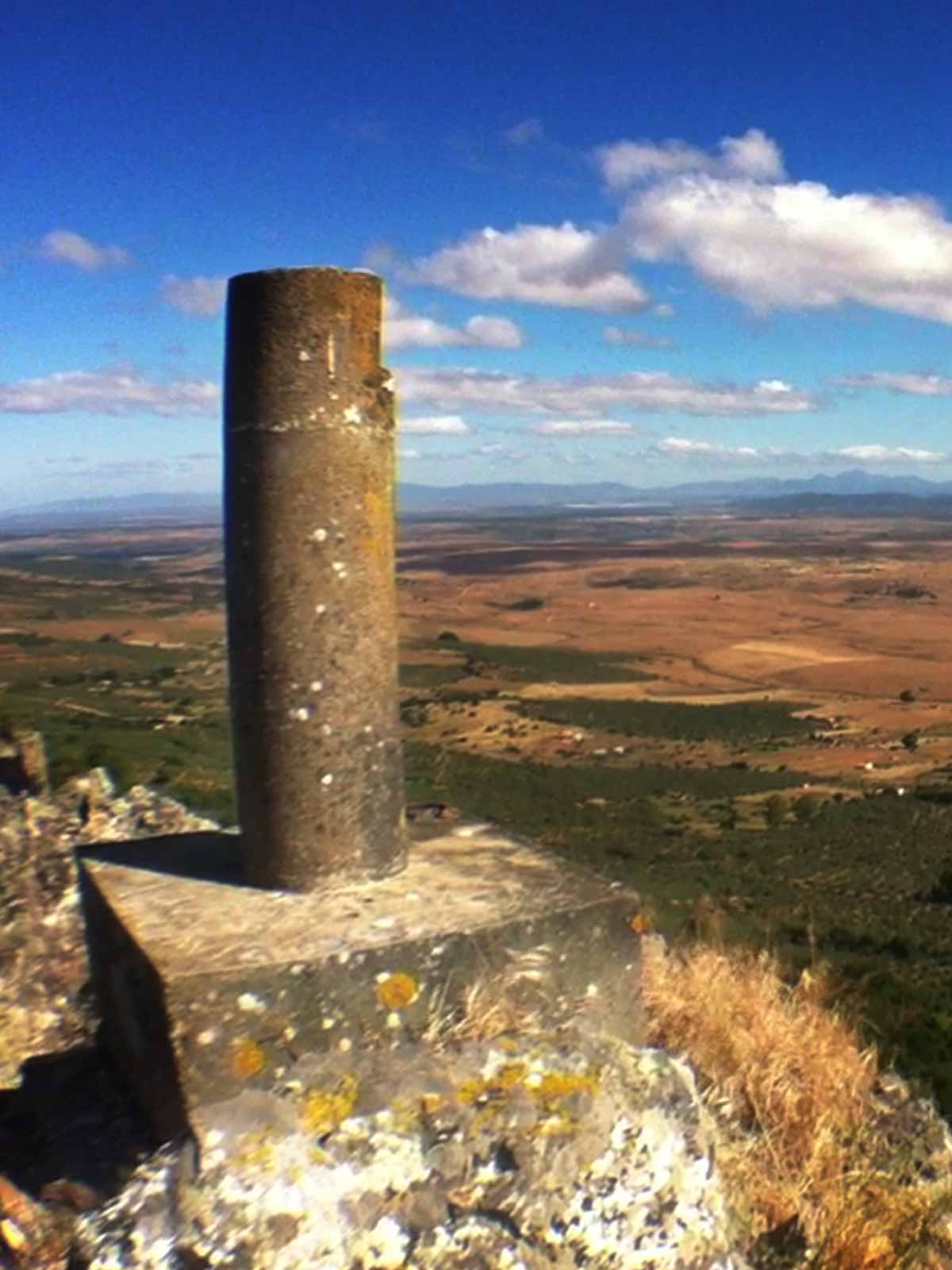
2. Climb to the Lookout point
(697mts, Total length (return) 3.8 km approx.)
Known as the lookout point for the village, we climb to geodesic point «Rachado», a climb of medium difficulty if done from the road up to the castle or it can be made from one of the streets leading up from the village. From this point you can get unique snapshots of the entire mountain range. Once you have reached the lookout point, we can continue with the unmarked route to the end of the castle mountain range, where we can enjoy the diverse landscapes that surrounds the route.
-
-
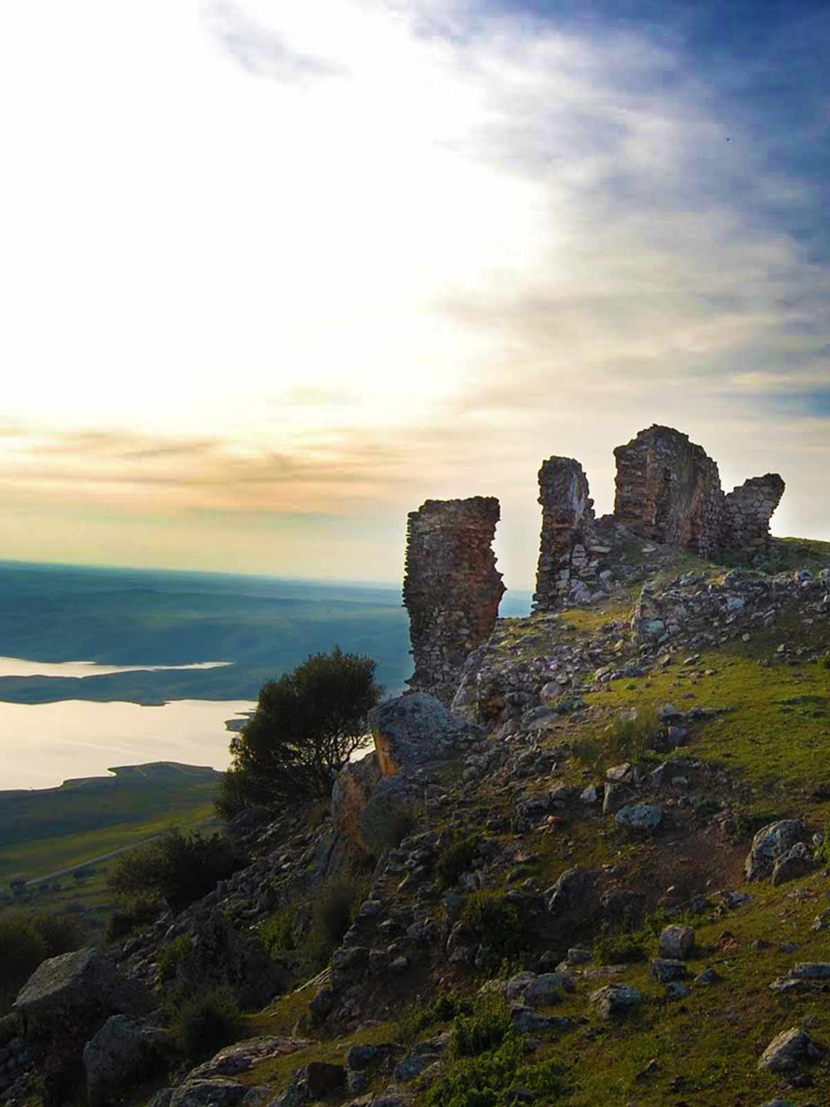
3. Fortress Trail de Lares
(Height 644mts, Total length (return) 4 km approx. from Galizuela)
This route can be accessed from the hamlet of Galizuela (end of Esparragosa de Lares) to the foot of the mountain range of Lares leading up to the remains of the ancient fortification. This route is of an easy level and can be combined with one of the other routes that we can show you. There is a path from the Castle of Puebla, so we can take the routes of both fortresses in one day. In addition to these trails, you can enjoy the mountain range of Lares, since it has a large colony of vultures and unique views of the entire reservoir La Serena. In ancient times it was known as Magic Mountain, because housed inside was an iron mine and it produced strange events due to the magnetic characteristics of this material.
-
-
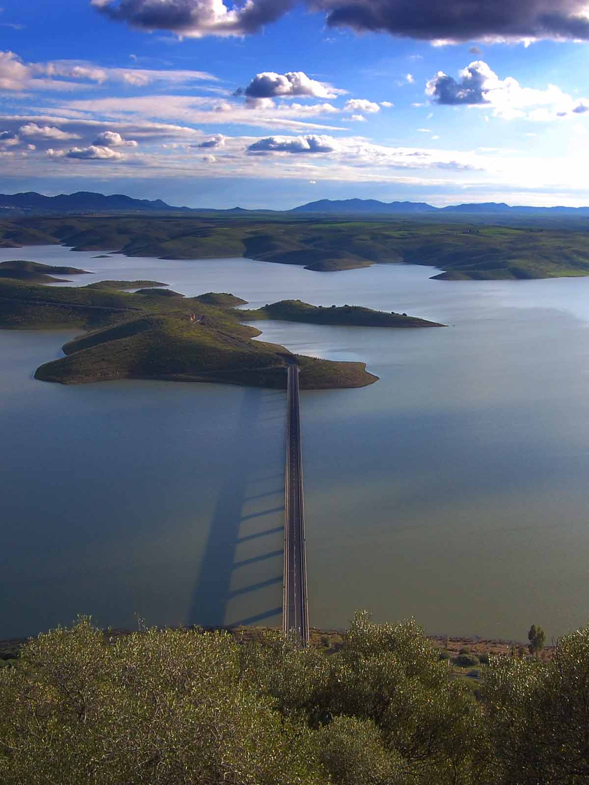
4. Climb to the volcanic cone Masatrigo
(Height 528mts, Total length (return) 2.5km approx.)
We may promote this as an almost perfect cone, which is surrounded by the reservoir of La Serena (the finish of Esparragosa de Lares), which can only be reached by road EX322. There are a few parking spaces where we can leave our cars and begin the climb. At the top there are platforms where we can relax and take pictures of the surroundings.
-
-
5. Road to Puebla de Alcocer / Orellana la Vieja
(430 mts Height, Overall length (return) 32.3 km approx.)
We can enjoy one of the phases of the natural path of the Guadiana, which consists of 44 stages that take place over 933km and follow the natural course of the Guadiana River from the Natural Park of the Lagoons of Ruidera to Ayamonte.
Stage 24 «Puebla de Alcocer – Orellana La Vieja», runs through oak groves, pastures and the Orellana reservoir. It begins on the outskirts of our village and goes to the Orellana reservoir, through Orellana de la Sierra and ends in Orellana la Vieja. A journey of 32 kilometers passing through protected areas, such as SCI (Site of Community Importance) and ZEPA (SPA – Special Protection Area for Birds). The Orellana reservoir and mountain range of Pela» stage runs through pasture lands, oak trees, olive trees and large private sheep farms. Here you will findbeautiful surrounding landscapes, among which are Carneril Island, Cogolludo and many others.
-
-
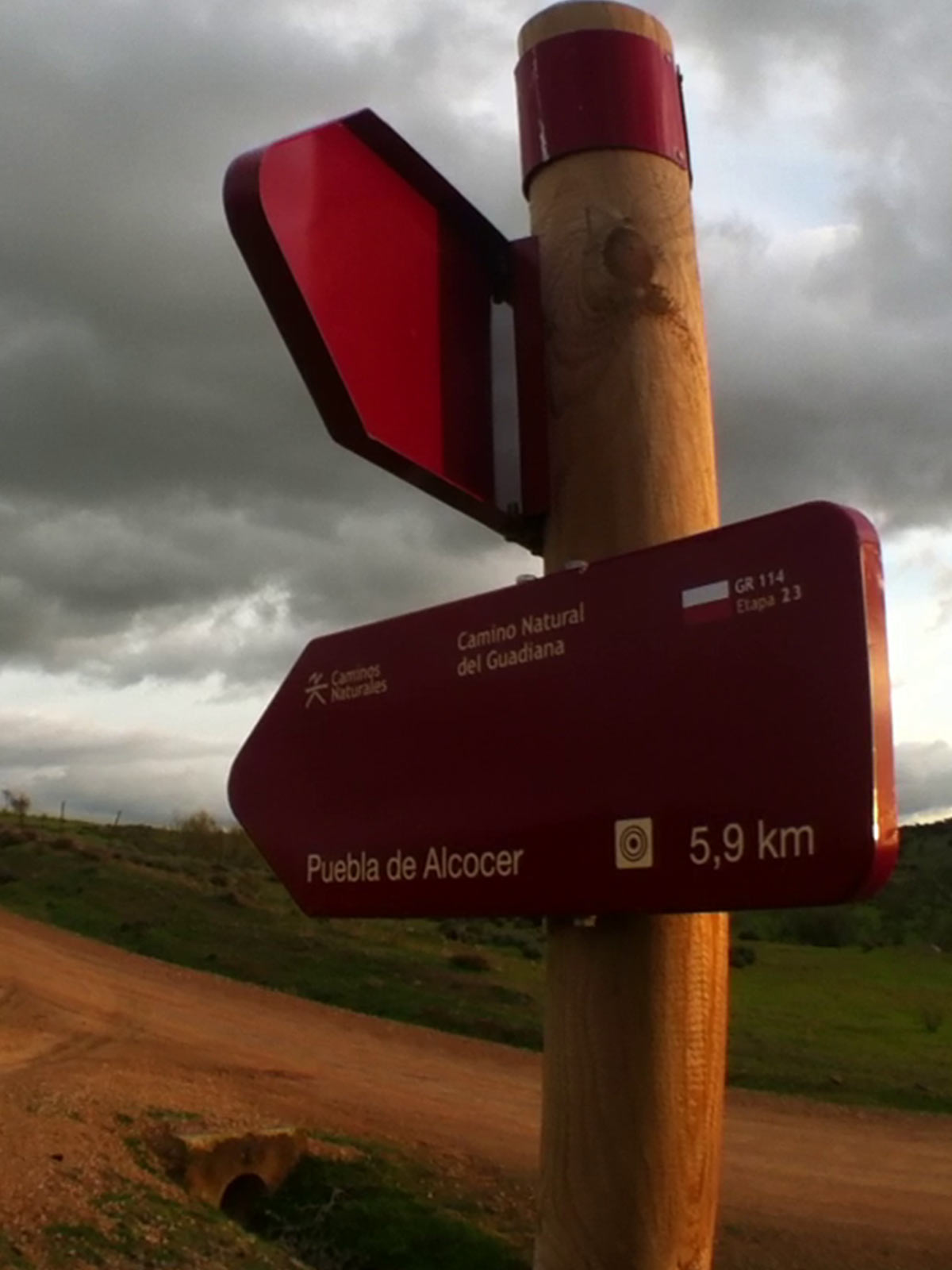
6. Road of Casas de Don Pedro/Puebla de Alcocer
(Height 230 meters, Total length (return) 20.4 km approx.)
Within the natural path of the Guadiana, in stage 23 «Casas de Don Pedro – Puebla de Alcocer,» we are able to enjoy a route searching for the shores of the Orellana reservoir, then it crosses the extensive area of pastureland on the southern bank. In the second stretch of the Merinas, we can take advantage of the track, the fenced cattle route that crosses through sheep farms is used. This stage begins in Casas de Don Pedro and sets off in the direction of the Orellana reservoir.
-
7. Route Celada
(946 mts Height, Overall length (return) approx 24km. from Siruela)
You can discover the public forest La Celada A, located at the end of the village of Garlitos within the ZEPA (SPA) area of the mountain range of Siruela. It is accessed from Siruela and Garlitos, by a forest trail linking both villages.
-
8. Fort of Garbayuela. Up to the Castle
(778 mts Height, Overall length approx 7.3km. from Garlitos)
It starts at the highest point of the Mirabueno mountain range, then goes down a few meters to visit the ruins of Celtic Fort. There is a path up to the Fort, then you have to hike down the existing path. Theroutecrossestheport of Zamoranos.
-
9. Puerto Peña Climb
(679 mts Height, Overall length approx 2.6km. from car parks Puerto Peña)
The signposted route that ascends the mountains of Puerto Peña (end of Talarrubias), you can enjoy a unique view of García de Sola reservoir and the region of Siberia. In addition you will find a large colony of vultures that live in the mountains of Puerto Peña.
-
10. Route of the Valleys of Consolation
(Height 642mts, Total length 11.3 km approx. from Herrera del Duque)
A place of incomparable beauty that can be accessed from Herrera del Duque and runs between the mountains of Consolation and La Mora, immersed in an area full of nature.